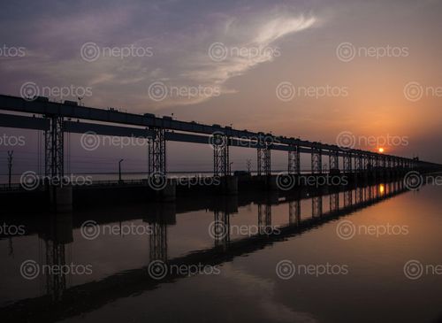

The Koshi Barrage is a sluice across the Koshi river that carries vehicular, bicycle, and pedestrian traffic between Saptari district and Sunsari district of Nepal. It is near the international border with India. It was constructed after the Koshi Agreement was signed between the Government of Nepal and India on April 25, 1954. The Koshi River, which in earlier days was known as the “sorrow of Bihar” due to flooding in the monsoon and drought in winter, became the “pride of India” (Bihar) when the Barrage was completed. It was constructed between 1959 and 1963 on the Nepal side of the Indo-Nepal border for the purpose of irrigation, flood control and hydropower generation. It has 45 spurs, 500 m apart, on the eastern embankments in Nepal. The Koshi is a 729 km long river, originating near Mt. Everest from the world’s highest glaciers — on the Tibetan plateau and in Nepal. The Koshi enters Bihar (the Northern most State of India) and finally ends at the confluence of Gangas, travelling from Nepal. It may be the only river in the world to horizontally change its course as much as 120 km in the last 250 years. The Koshi Barrage has a capacity of 950,000 cusecs in a peak flood. The Twelve to 16 km wide embankment has, unfortunately, also served as a silt trap, raising the bed of the river higher than the surrounding alluvial plane.